The returning marsh
- Location
- Sausalito, California, United States
- Year
- 2026
- Type
- Master Planning
- Status
- Concept master plan; not built
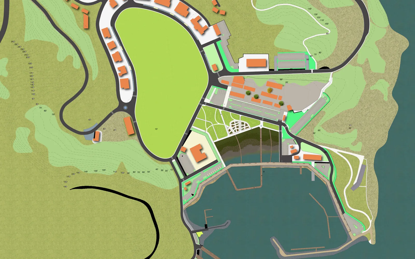
A master plan for the waterfront of Fort Baker, a former army post on Horseshoe Cove just north of the Golden Gate Bridge. The marsh that was filled in 1903 comes back, the cars move back from the water's edge, and the bay opens to the people who come to it.
Services · Site inventory and analysis, Precedent studies, Concept design, Master planning, Marsh restoration and planting design, Stormwater and green infrastructure, Parking and circulation planning, Hardscape and planting palettes
The site
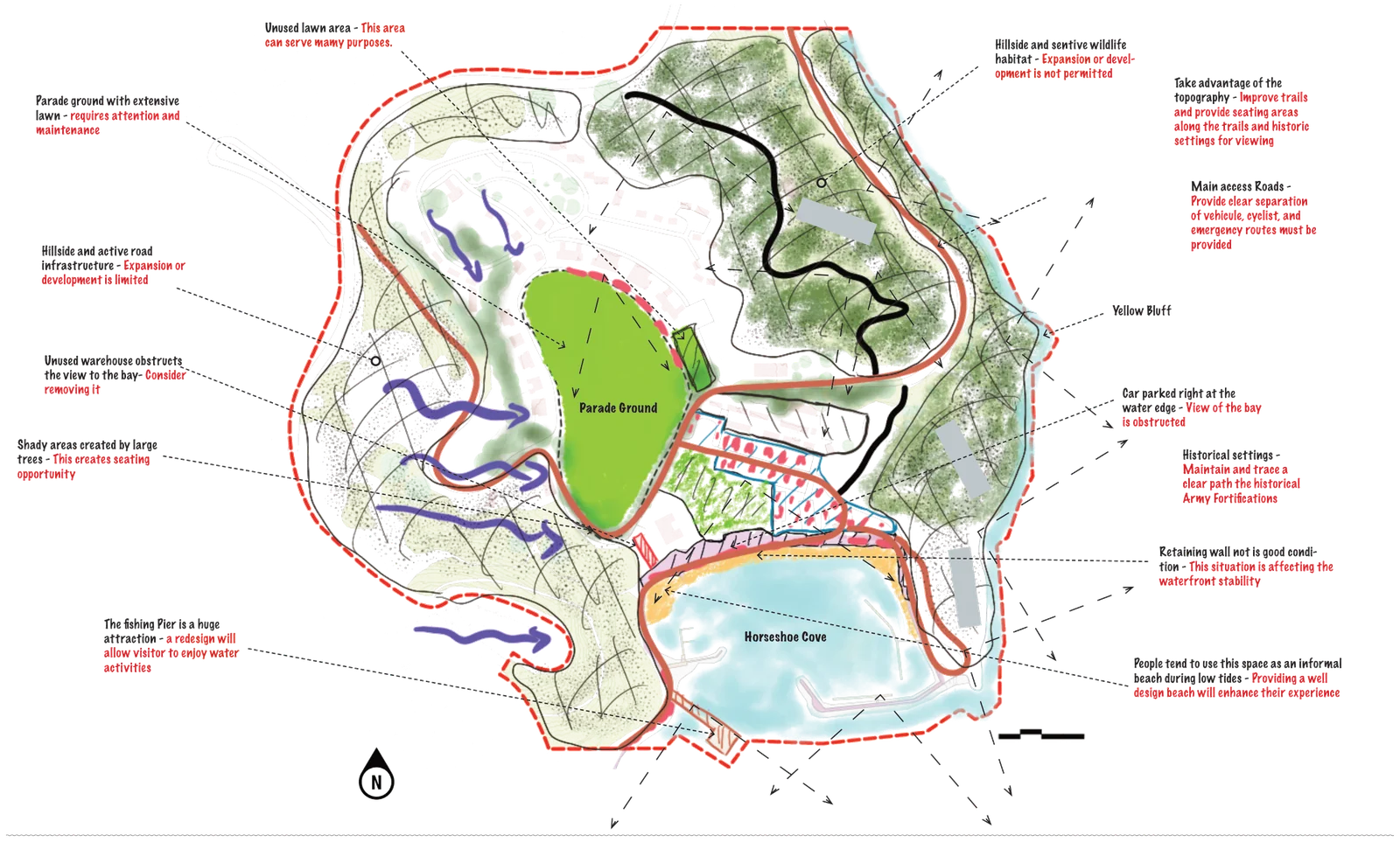
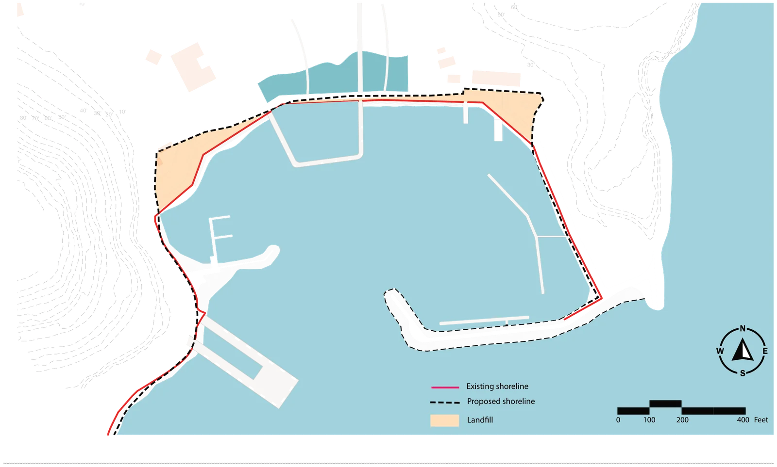
Fort Baker sits on Horseshoe Cove, directly north of the Golden Gate Bridge: 335 acres that were an army post from 1897 and passed to the National Park Service in 2002. The central valley is organised around the historic parade ground, and the batteries and roads of the coastal defences still set its structure. In 1903 the marsh at the head of the cove was filled to make usable land, raising the ground by up to about 12 feet. The waterfront stands on that fill today: made ground, a retaining wall in poor condition, and an edge exposed to sea-level rise.
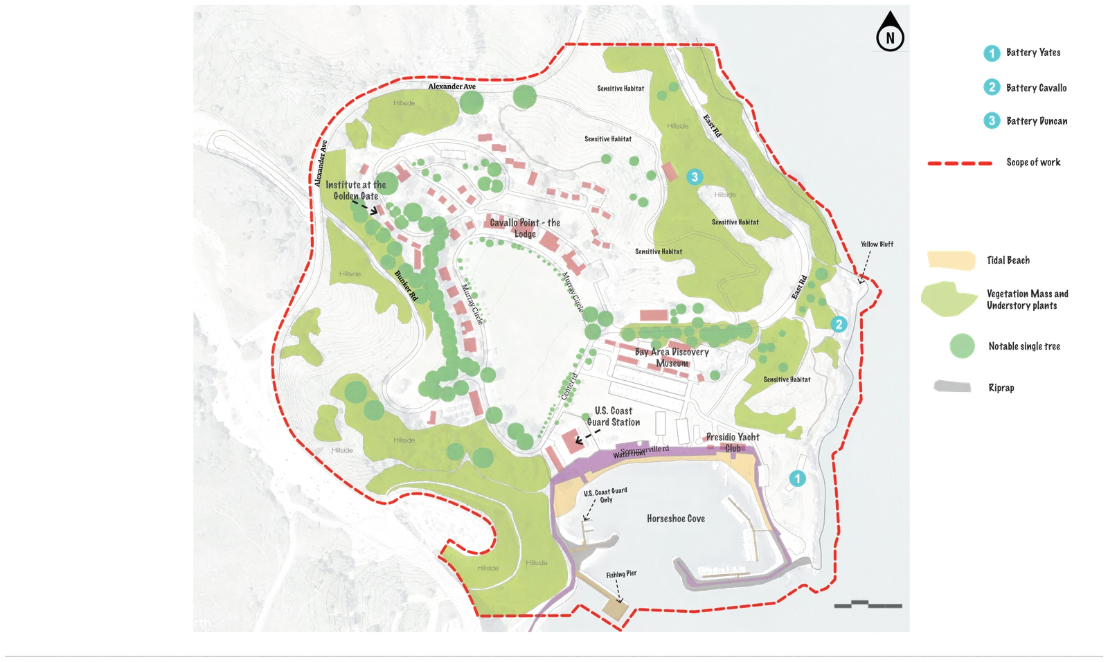
Vegetation and habitat
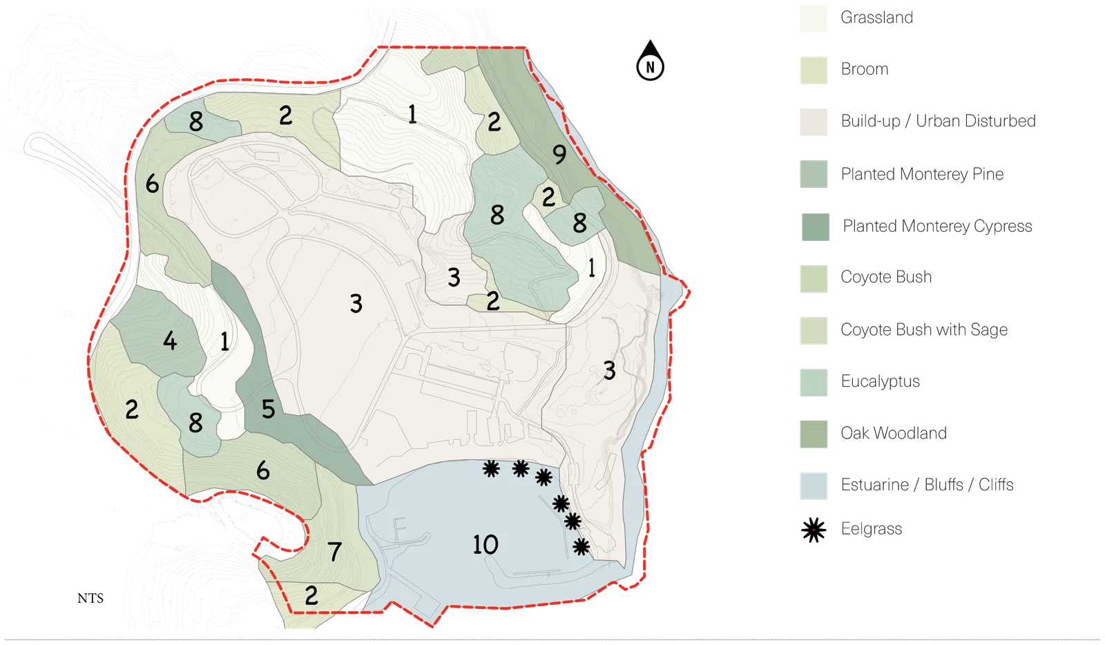
The hillsides carry grassland, coyote bush scrub with sage, broom and pockets of oak woodland, with planted Monterey pine, Monterey cypress and eucalyptus. Bluffs and estuarine edges ring the cove, and eelgrass grows in its shallows.
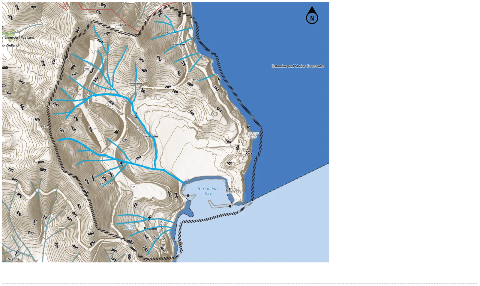
Slopes and water
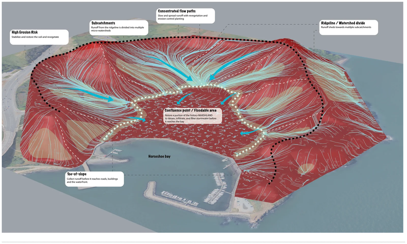
Rain on the ridgeline runs down the slopes in a set of small watersheds that gather towards the head of the cove, where the parking lots are, and the runoff drains untreated into the bay.
What the analysis found
About three visitors in four arrive by car. The site has 660 parking spaces, all free and all asphalt, and on summer weekend afternoons the overflow spills onto the roads and blocks the routes shared by pedestrians, cyclists and emergency vehicles. There is no shade over any of the main lots. Cars park right at the water's edge and block the view of the bay. At low tide people already use the shore as an informal beach, and the fishing pier is one of the site's main draws. The parade ground is historic and stays as it is.
First concepts
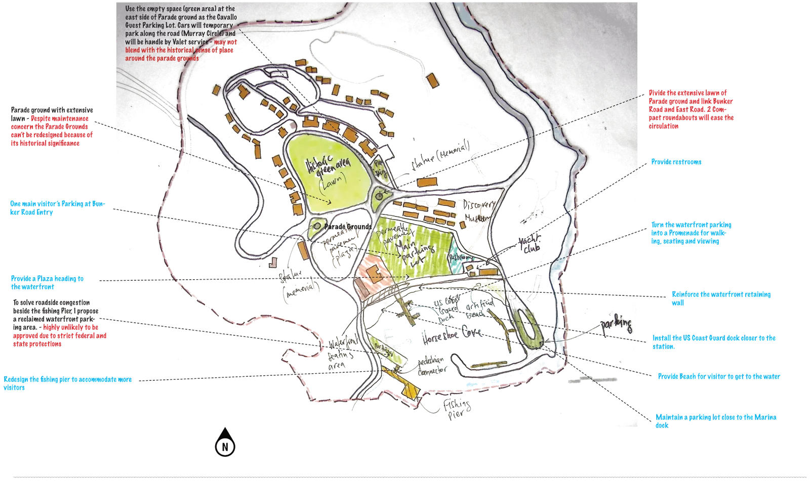
The first concepts tested how far the waterfront could change. They turned the waterfront parking into a promenade, redesigned the fishing pier for more visitors, reinforced the retaining wall, and added a beach, restrooms and a plaza leading down to the water, with one main visitor lot at the Bunker Road entry and a lot kept near the marina dock. Some ideas were dropped along the way: a reclaimed parking area on the waterfront would have been very unlikely to be approved under federal and state protections, and valet parking around the parade ground did not suit its historic setting. Precedents informed the next step: Crissy Field in San Francisco, Charleston Waterfront Park, and the permeable parking at the Morton Arboretum.
The concept revisited
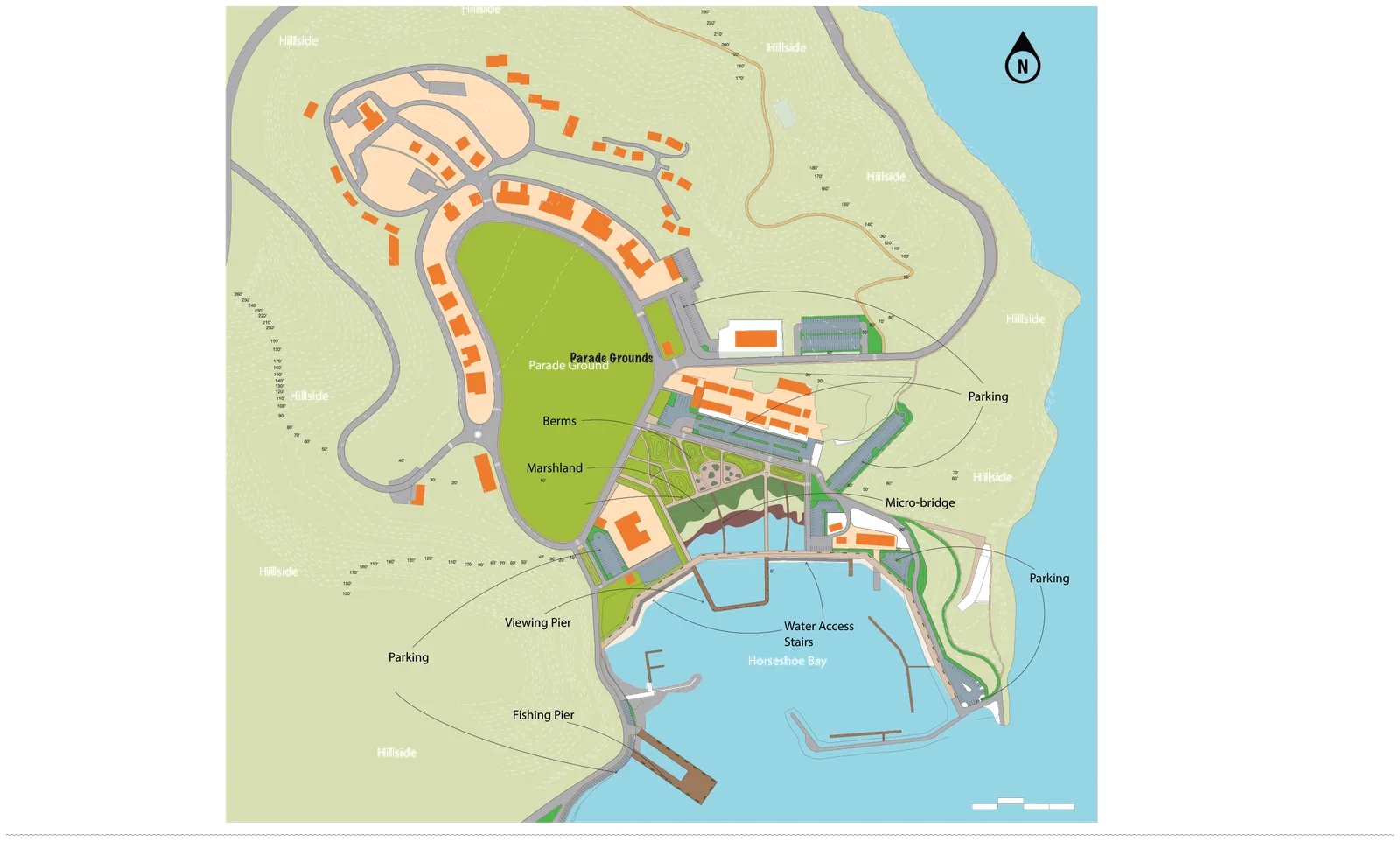
The revised concept keeps the parade ground unchanged and gives the head of the cove back to water and people: a tidal marsh with coastal dune, a viewing pier, a redesigned fishing pier, a kayak ramp, water-access stairs, berms, and an open space with a plaza and native plant garden, with parking kept near the marina dock.
Bringing the marsh back
The idea is to bring the marsh back and open the bay to the community. The restoration is an earthwork strategy as much as planting: remove part of the fill, regrade the tidal section, reconnect the bay, then let sediment, tides and native vegetation rebuild the marsh over time.
The marsh
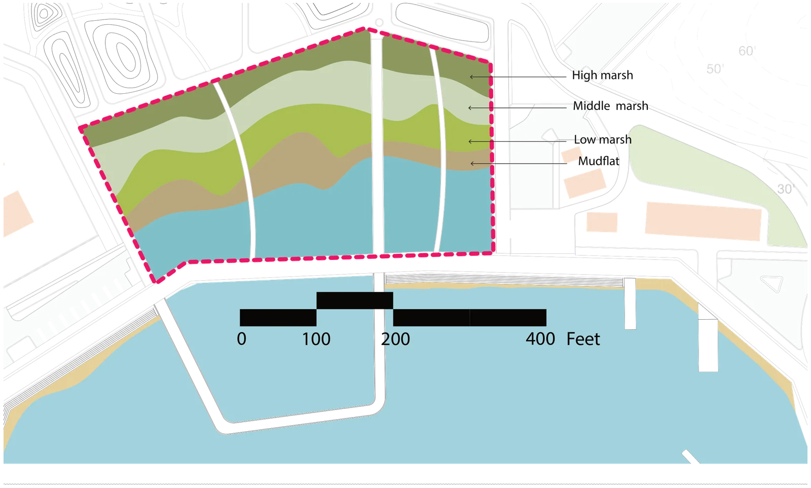
Planting follows the tide. Eelgrass at the subtidal edge, open mudflat with Pacific cordgrass at the lowest intertidal zone, pickleweed in the middle marsh, and marsh gumplant and saltgrass in the high marsh.
Runoff and the marsh
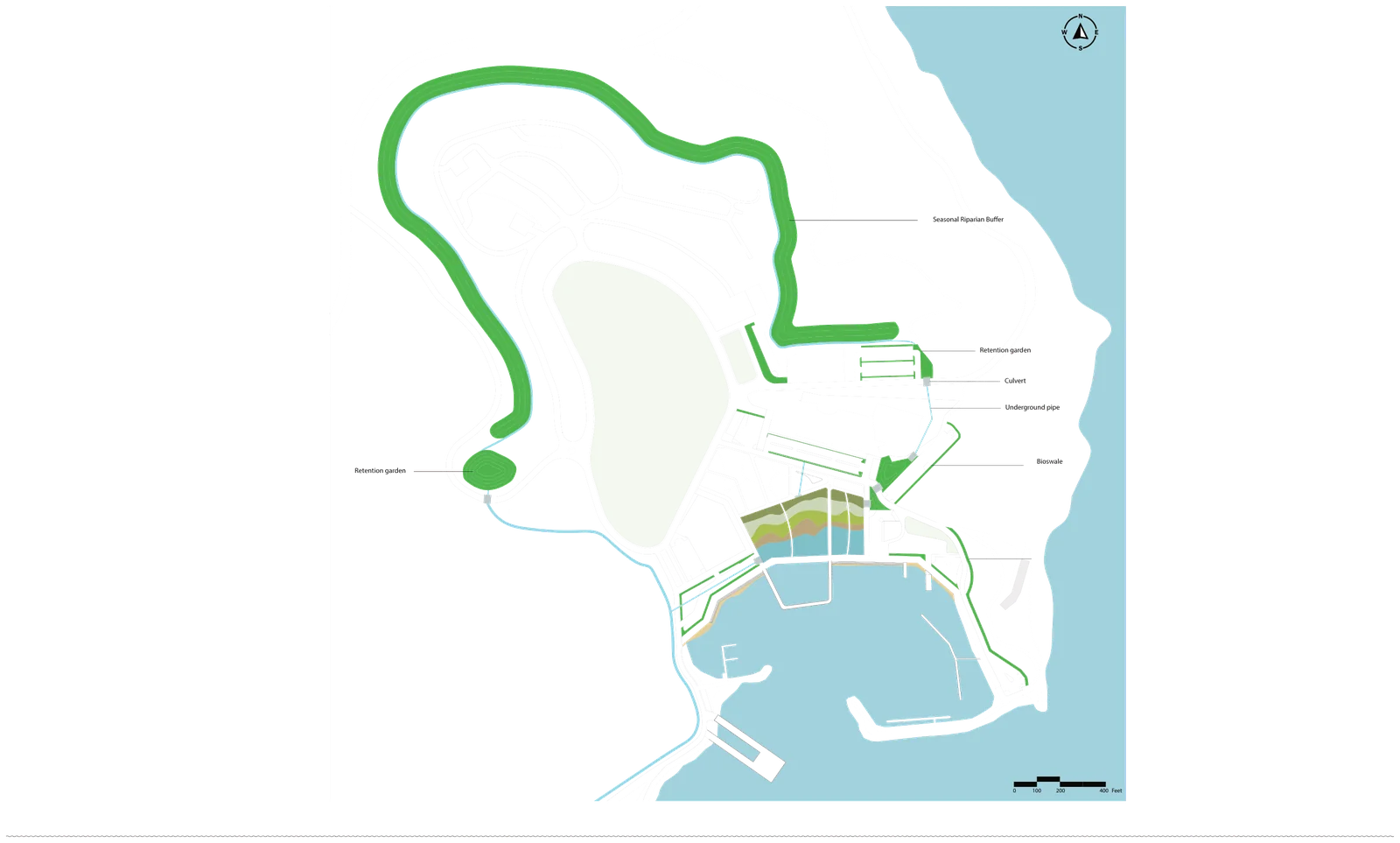
The marsh also does the site's stormwater work. Runoff from the ridgeline is split into small catchments, slowed on the slopes with erosion-control planting, collected at the toe of the slope, and held in the marsh, which detains, infiltrates and filters it before it reaches the bay.
The master plan
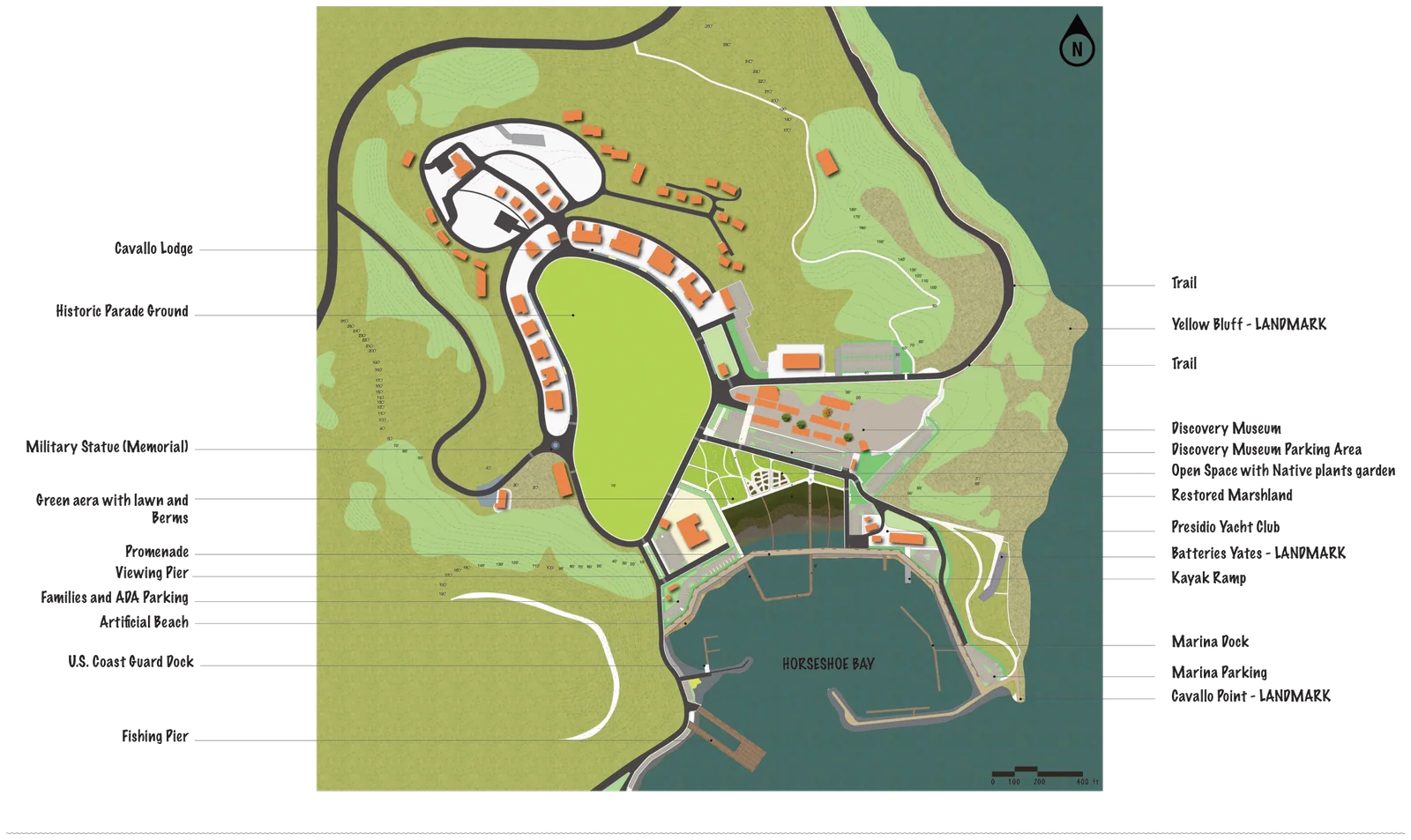
The master plan draws it together: the restored marshland at the head of the cove, a promenade along the water, a viewing pier and the fishing pier, an artificial beach and a kayak ramp, a green area with lawn and berms, and an open space with a native plant garden. The historic parade ground, Yellow Bluff and Battery Yates stay as landmarks, and trails connect the waterfront to the hillsides.
The waterfront
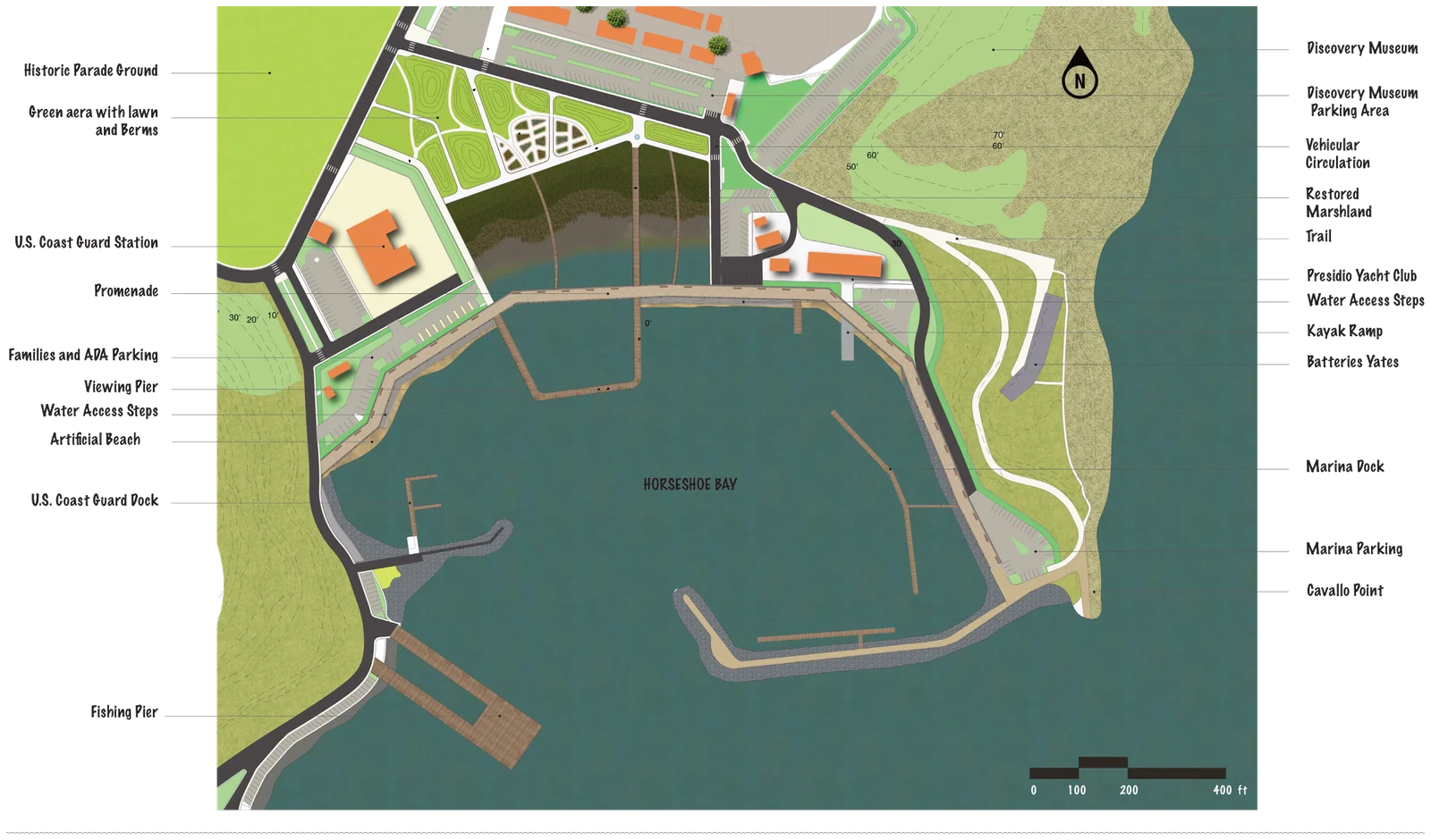
The parking at the water's edge becomes a promenade for walking, sitting and looking out. A viewing pier and a redesigned fishing pier take more people onto the water, with water-access steps, a kayak ramp and a beach where visitors already gather at low tide.
Parking
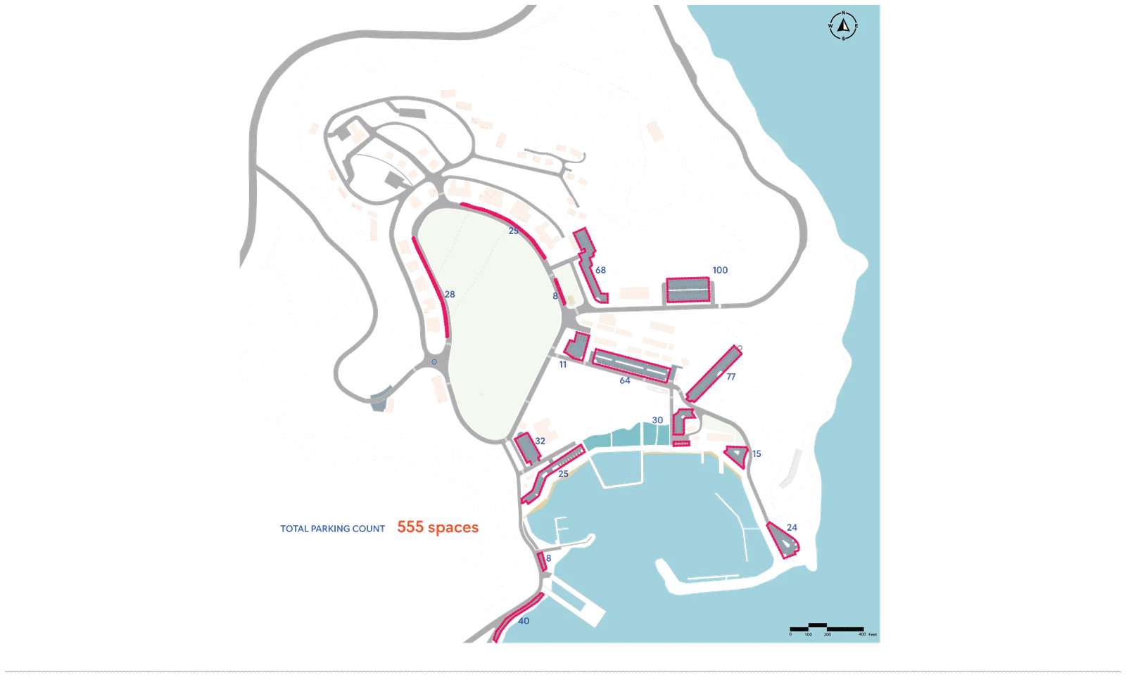
Parking is reorganised into 555 spaces, down from 660, with family and accessible parking close to the waterfront and a lot kept near the marina dock. The plan moves from building more parking to managing it: paid parking could fund a frequent shuttle to and within the site.
Walking and cycling
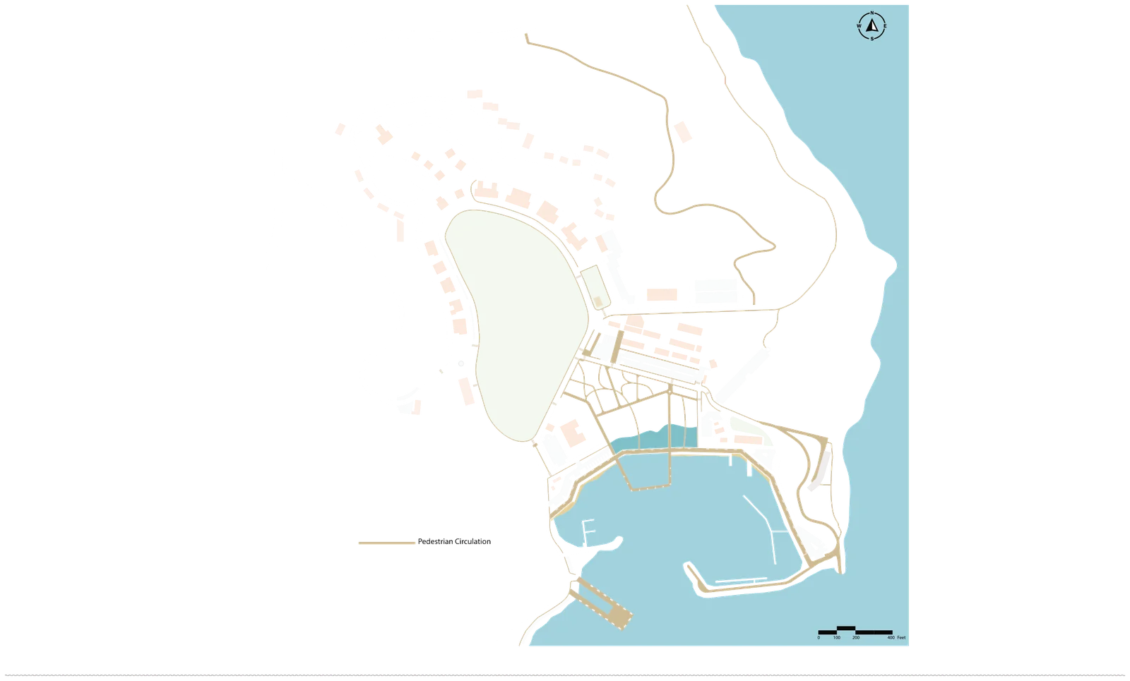
Better pedestrian, cycle and shuttle links make it possible to arrive without a car, and a clear separation of routes keeps walkers, cyclists and emergency vehicles apart.
Green infrastructure
The lots are laid in permeable interlocking pavers. Bioswales, culverts and retention gardens carry and hold the runoff, and a seasonal riparian buffer is planted with native sedges and shrubs such as Pacific wax myrtle, creek dogwood and toyon.
Sections
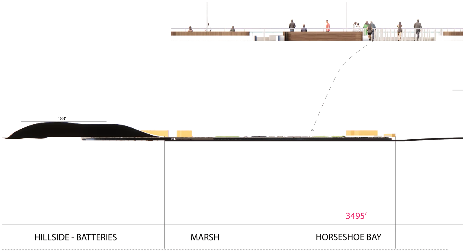
Three section cuts run across the site. This one runs from the hillside batteries across the marsh to Horseshoe Bay.
What was delivered
Site inventory and analysis; concept explorations and precedent studies; illustrative and rendered master plans and an enlarged plan of the waterfront; shoreline, marsh, circulation, parking and stormwater plans; three site sections; planting and hardscape material boards; and perspective views of the design model.
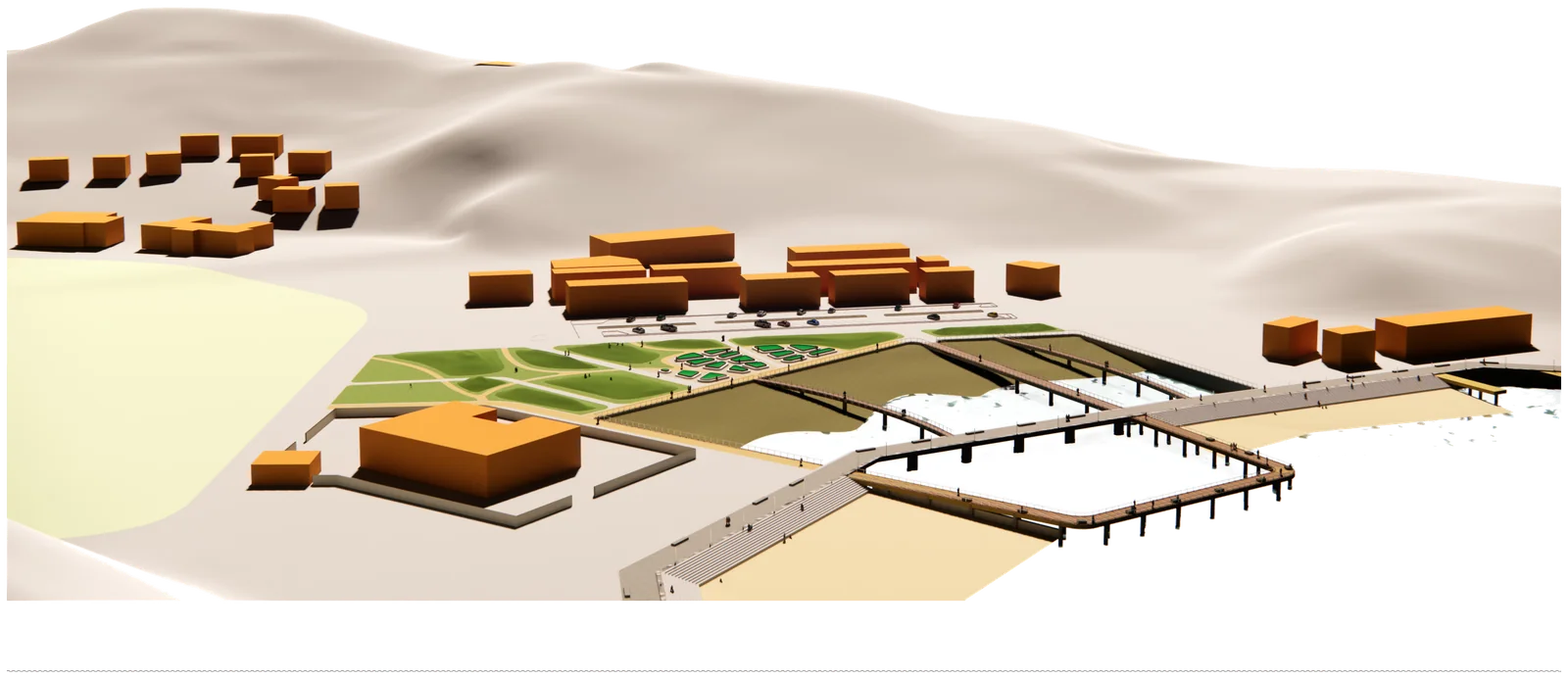
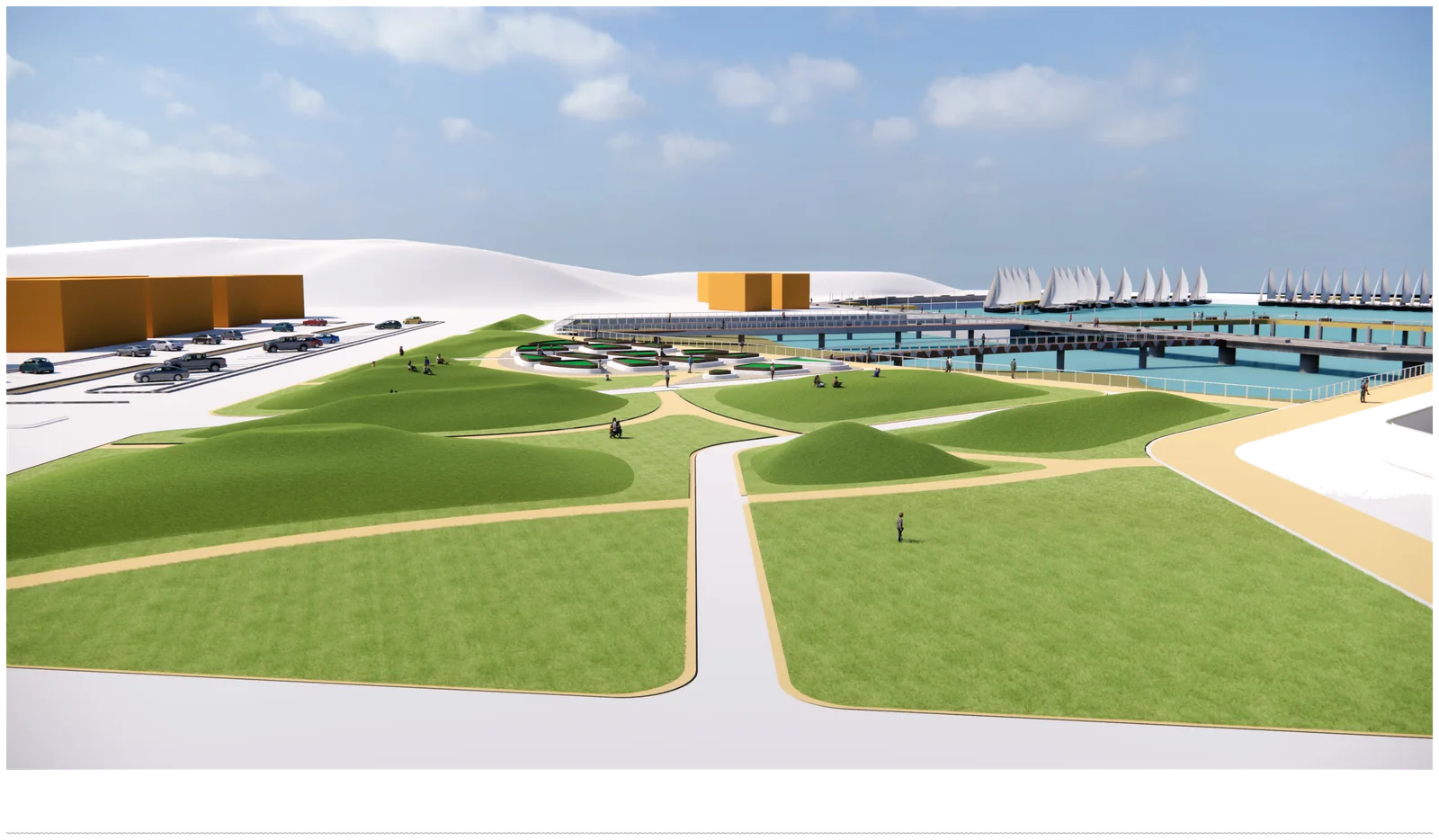
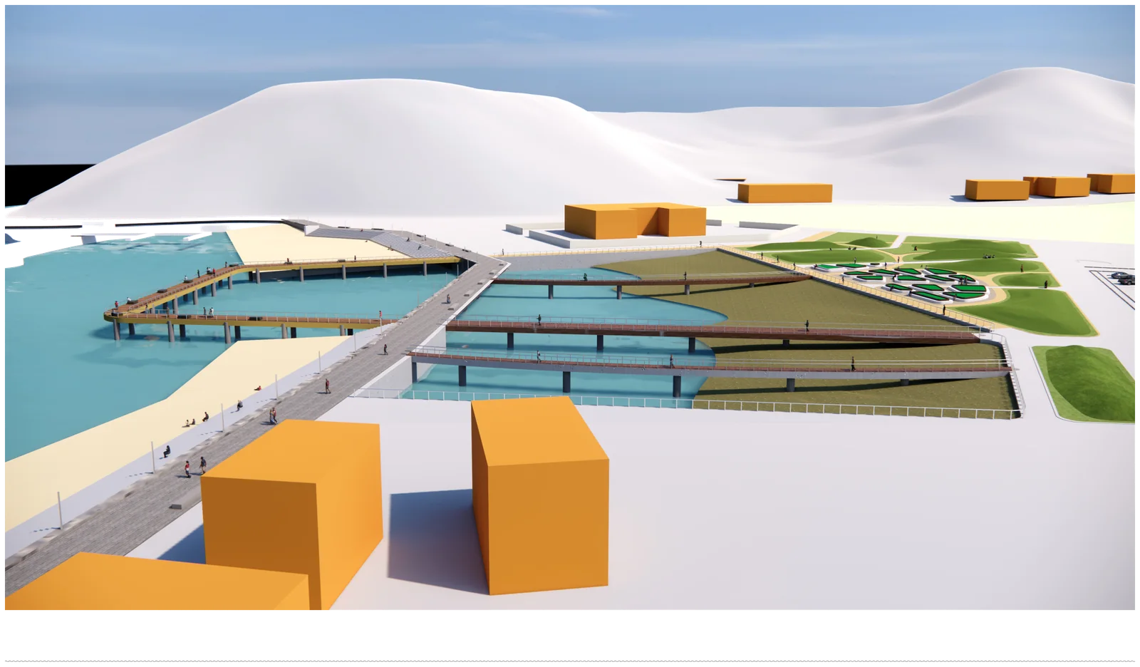
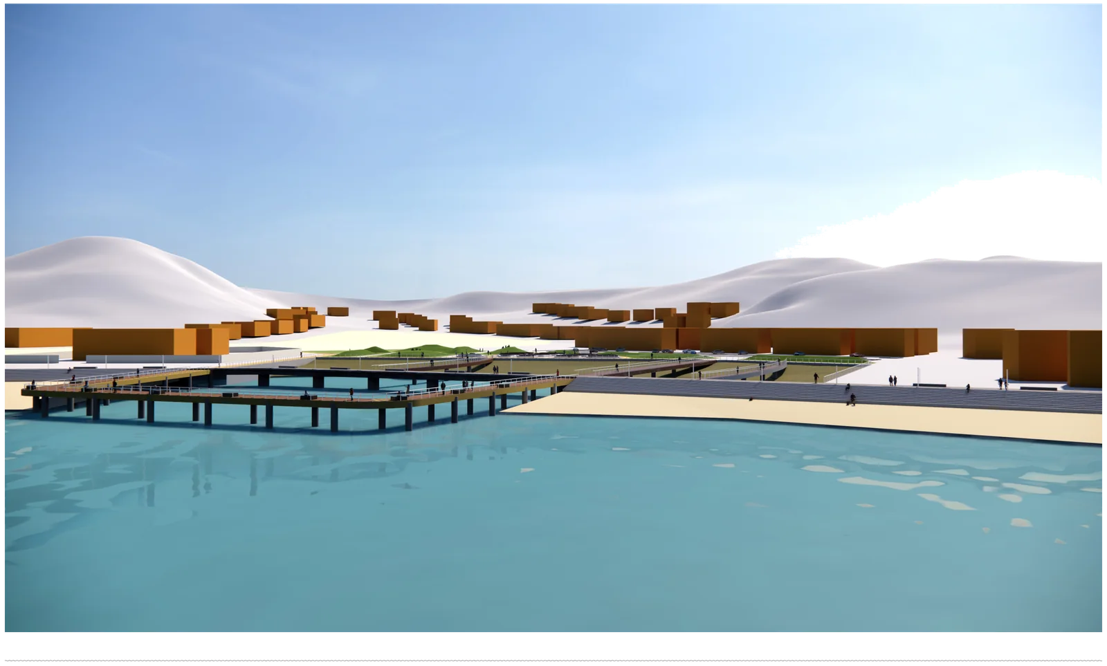
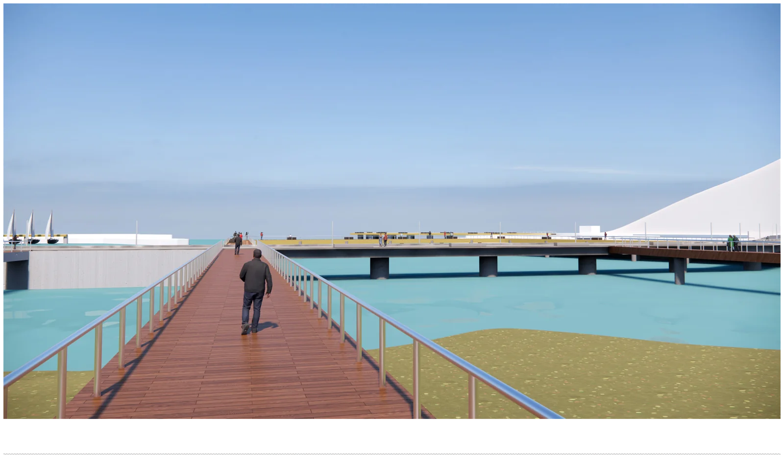
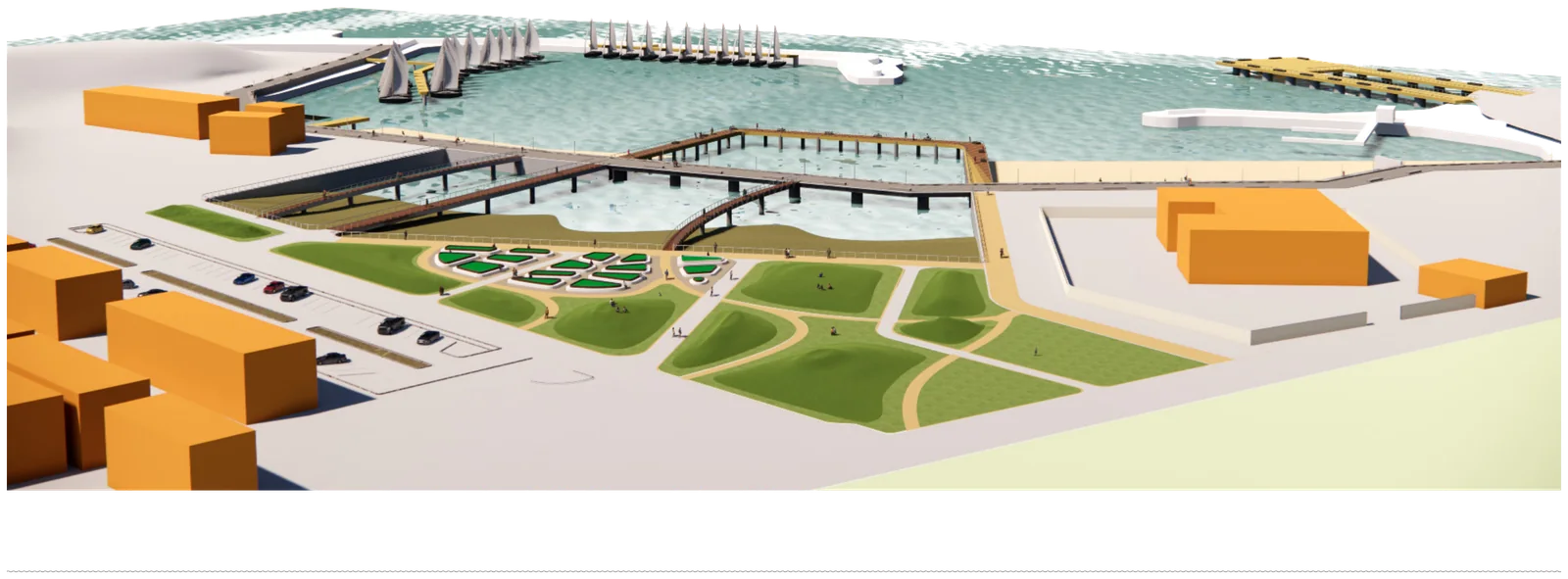
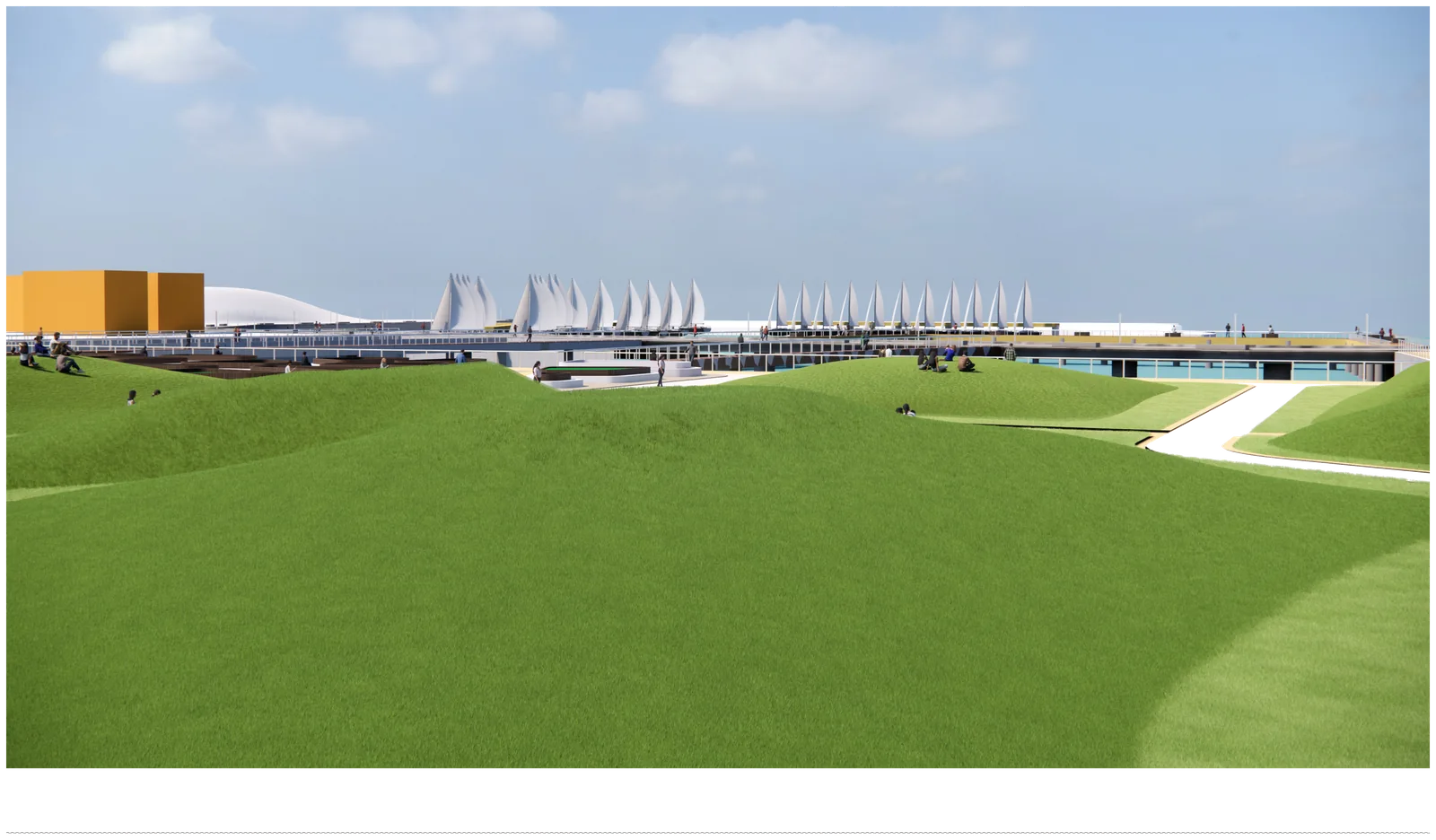
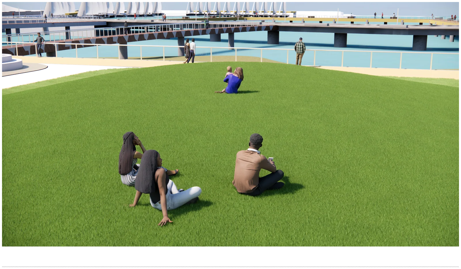
All images are drawings and renders of the design model, not photographs. The scheme has not been built.